


A graduate student analyzing publicly available drone data in Mexico unexpectedly stumbled across a huge ancient Mayan city buried beneath dense jungle.
For centuries, the city lay hidden amid jungle canopy in the state of Campeche, on the Gulf of Mexico. New research published Tuesday in the journal Antiquity reveals sites that in total cover area about one-and-a-half times the size of Washington, D.C.


Researchers uncovered the densely packed area containing 6,674 structures, including pyramids resembling those at Chichén Itzá in the Mexican state of Yucatan, and Tikal, an ancient citadel in the rain-forests of northern Guatemala.
The data, gathered by a research group studying land-use patterns, came to light using modern drone mapping technology known as LiDAR — light detection and ranging equipment.
LiDAR maps are used by a wide range of researchers to collect data for archeological and non-archaeological purposes, but Auld-Thomas took the data and analyzed the maps with methods used by archaeologists.
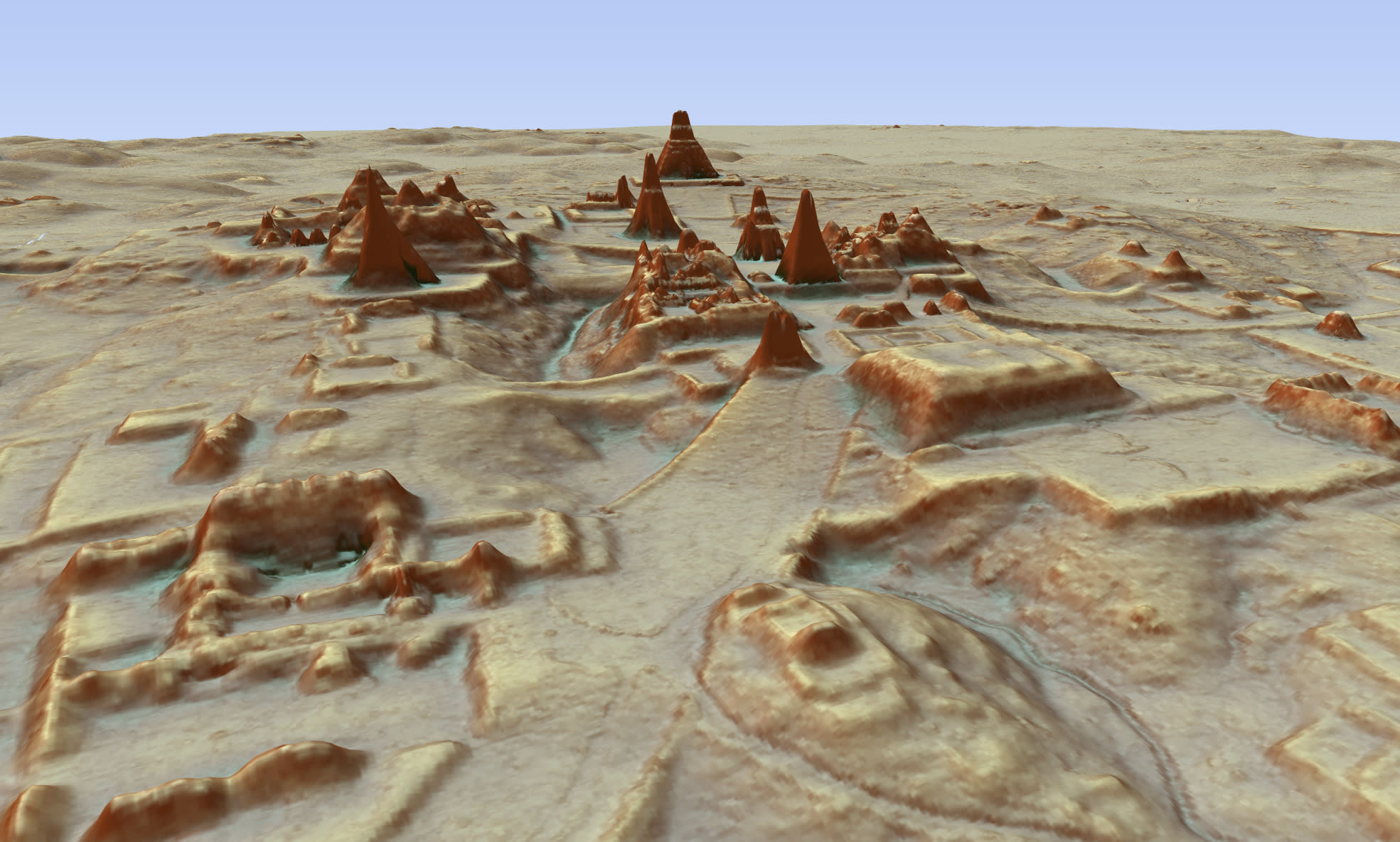


A research team then went on to discover a huge ancient city that they named “Valeriana” after a nearby freshwater lagoon.
The researchers say Valeriana, which may have been home to 30-50,000 people at its peak, probably collapsed between 800 A.D. and 1,000 A.D., for a complex set of reasons.
LiDAR technology is a recent advancement over the past decade that has revolutionized archaeological research, especially in densely forested areas.


The technology is capable of revealing extensive, previously unseen layers of history embedded in remote regions that would otherwise be inaccessible.
By covering large expanses of ground with precision, LiDAR allows researchers to uncover hidden structures.
Although this study is the first to reveal Maya structures in east-central Campeche, archaeologists are finding areas with layers of human activity are more common than once thought.
NBC / ABC Flash Point News 2024.

Mayan like Inca societies were destroyed by Spanish invaders !